May 18, 2021
Weather Radar and Boaters
All Boaters need to understand weather radar.
In the old days, weather forecasters based their predictions on a combination of things:
2. Good eyesight (a weather eye); and
While today’s boater likely will look at his cell phone rather than looking up at the sky. For example, my wife can predict a change in weather by the pain in her elbow. She’s pretty accurate and she’s getting old too. (Note: I don’t let her read these.)
When dark clouds start building, having a basic understanding of how weather works can give you a head start on preparations.
Not all thunderstorms are intense, but they all are potentially dangerous. Boaters are especially vulnerable to the weather. They can’t simply run “inside” for protection. It pays to have basic weather-reading skills — so you can be prepared.
Here’s some help:
The Basics of Weather

Dark Clouds
Clouds
Whole books have been written on how to predict the weather by looking at clouds. Most people have a hard time remembering all the different types and what they signify. Here’s a simple rule of thumb: slow clouds get lower, or puffy clouds grow and get higher. Keep an eye out for rain or a storm. When looking at the sky, it’s helpful to remember that most weather changes come from the west. So keep your weather eye in that direction.
Generally, the slower the clouds change, the longer the duration of the weather change.
Thunderheads form quickly and dissipate just as quickly. Slowly thickening clouds associated with a cold front often mean a soaker.
Winds
Most of the time, winds are light in the morning. The winds pick up in the afternoon, and then return to light again as evening approaches.
If you find the wind speed not following the usual local pattern, suspect a change coming.
The direction of wind changes can also give you a heads-up to what’s coming. If the wind changes clockwise — say, from the south to southwest to the west — it usually means fair weather on the way.
If the wind changes counterclockwise, it usually signifies the approach of foul weather. An example would be, winds changing from the west to southwest and then to the south.
During the formation of a “pop-up” thunderstorm, the wind doesn’t always follow that rule. A “pop-up” thunderstorm often comes straight down from the clouds. It then spreads out in all directions. If you feel a sudden cool wind, check the sky for towering clouds.
Food for thought: When the speed of the wind increases, its effect on your boat rises exponentially. Your boat acts like a “sail.”
Did you know that a 20-knot wind has four times the force of a 10-knot wind?
Barometers

Weather Barometer
Barometers are more than just pretty brass instruments. The have a useful purpose. It’s just that most people do not understand their purpose – but they do look good.
Knowing what they’re saying can alert you to the advancing weather. Barometers are typically marked with areas of the face declaring “fair,” “changing,” and so on. The wording is misleading since reading a barometer is about noting changes.
A falling barometer usually means bad weather is approaching. It’s as much the speed of the change as the change itself that’s important to note.
A rapid fall means more significant changes. The normal pattern is a small up-and-down change that you can ignore.
A rapid rise may mean fair weather with strong winds. Typically, checking a barometer every couple of hours is adequate. Look for the direction of the change.
Thunder
If a thunderstorm is approaching, listening to thunder can tell you a lot about it. Counting the seconds between a “flash” of lightning and the “boom,” gives you the distance from the lightning. A five second difference equals about a mile.
Parents: if your children are afraid of thunder and lightning, explain that it is miles away. Then, distract them by asking them to count the seconds between the lightning and the thunder. It becomes a game for them, and they become less afraid of the noise.
Radar
Check the radar on your phone. Use the zip code 54301 for Green Bay. This is where the National Weather Service (NWS) is located. Their radar map includes the entire Door County peninsula.
The radar map will tell you where a storm is and where it’s heading. But, do not rely totally on radar. Because of the size of the Bay and Lake Michigan, there are frequently “pop-up” storms. That means unless you are actively looking at the radar, you can miss the approach of these storms.
Radar gives you the range and movement of the rain, allowing you to change course to avoid the worst. If the storm overtakes you – turn the boat “into” the waves and reduce speed.
Keep in mind, using the hourly radar will tell you where the rain is, but only a little information about the winds.
If you feel a sudden change in temperature, it signifies a change in wind intensity is coming. Start looking for a safe harbor, just in case.
Knowing the forecast before you head out is equally important.
BoatUS App
You can download and use the BoatUS App to track the weather. You’ll get small craft advisories and weather forecasts. Authorize “notifications” to receive updates about storm information. These occur each time NOAA tracks a storm heading your way.
NOAA
The most prominent weather data forecasts come from NOAA’s National Weather Service (NWS). NWS broadcasts weather for all parts of the U.S. via the Internet. It issues regular updated VHF broadcasts. All modern VHF radios can tune in to the forecasts, which operate on one of seven frequencies. Scan through the channels to find the best reception. Boaters can hear the computer-synthesized voice 25 miles or more from the transmitter.
The NOAA website lists current wind speed, wave height, and more at a nearby weather buoy. Go to: www.ndbc.noaa.gov for a look.
Weather Folk Lore
Red sky in morning, sailors take warning, red sky at night, sailors’ delight.

Pink Sky – Sailors Delight
Ever wonder what that means?
At night, a red sky signifies light passing through dust particles in the air in front of the setting sun. Dust indicates dry weather. Since most weather changes come from the west, a red sky at night means dry weather is approaching.
A red sky in the morning indicates that the dry air has moved east. Rain may be coming, especially if you see illuminated clouds.
If the morning sky is a deep fiery red, it means high water content in the atmosphere with the likelihood of rain. A gray sky at night means that the western air has a lot of moisture; therefore, it will likely rain soon.
One thing to remember: this rhyme can’t predict thunderstorms developing in the afternoon. Especially, when the morning has already been clear.
A summer fog for fair, a winter fog for rain.
Fog forms when the air cools enough that the water vapor condenses. When moist air moves over cold land, it will bring fog and possibly rain. For the air to be cool on a summer night, the sky must be clear. With clear skies, the excess heat can radiate into space. Cloudy skies act like a blanket, absorbing and re-radiating the heat, keeping it in.
If it is clear and cool enough for the fog to form on a summer morning, it should be clear later or at least by the next day.
When a halo rings the moon or sun, rain’s approaching on the run.
The halo around the sun or moon is caused by ice crystals high in the sky. A warm front is approaching and usually rain will be here within 24 hours. The rhyme is more accurate in the summer than the winter.
The higher the clouds, the better the weather.
High clouds mean both dry air and high atmospheric pressure. These indicate fair weather. Lower clouds mean approaching rain.
Marine Warnings and What They Mean
- Gale Warning: This is published when winds will be in the range of 34 to 47 knots.
- Storm Warning: This is issued if winds between 48 to 63 knots are forecast.
-
Special Marine Warning: This warning is for boaters, in particular. It is issued whenever a severe local storm or strong wind of brief duration is imminent. It is not covered by existing warnings or advisories.
To sum this up – Learn all you can about clouds and winds – It can mean the difference between a nice cruise and a disaster.
Where can I find Pier & Waterfront Solutions?
Pier & Waterfront Solutions, 7325 St. Hwy 57, is located 3 miles south of Sturgeon Bay. Go 1 mile PAST the intersection with County MM (heading north). Look on the right at the intersection of Idlewild Road and Hwy 57.
PWS is

Pier & Waterfront Solutions remains “open” year-round.
The Covid-19 virus is beginning to wane. We can only hope people will continue to get the vaccine to help slow this illness. We continue to conduct as much business as possible by email, text, or phone.
Site visits continue as usual. When making in-person contacts, we follow “social distancing” guidelines when possible.
PWS display yard – OPEN 24-7
Red Tag
PWS‘s display area is always open for you to examine at your leisure. All displays available for sale have a numbered, red tag on them. Want more information on something you saw in our yard? Please reference that number when you inquire.
PWS provides estimates by email to make the process faster, safer, and paperless.
Call, message, or email Jerry with any questions.

Jerry Englebert
Contact Jerry at 920-493-4404 for more information or use this link.
May 4, 2021
May – Water Safety Month
Water Safety Month is here. With the start of Summer right around the corner, it’s time to start thinking about FUN IN THE SUN! You’ve been waiting for it – Now ENJOY IT!!
You want all your family and friends to be safe, and you would never allow an injury to occur. Let your family enjoy the entire Summer on the water! Here are some helpful tips to keep you in the sun all Summer long!
For Safety – Always wear a life jacket!
Whether you’re on a boat or a personal watercraft, always wear a personal flotation device for personal safety. Young children should always wear life jackets anytime they are in or on the water. A life jacket is the first line of defense against drownings.
They will insist that they can swim so they don’t need one. Can you ensure there will be no leg cramps or a head injury? Either of these would render them unable to “swim like the fish they think they are”? Don’t give in! YOU are the ADULT. Make them wear a floatation device for their safety.
Ensure that the life jacket fits snugly but comfortably. Make sure it cannot slip above the chin or ears when tugged on at the shoulders. Life jackets must be worn correctly to keep them safe.
Do you really want to find out what it’s like to lose a child, a friend, or a grandchild? Be the adult and insist they wear a life jacket.
Pay Attention to the Weather
Summer weather can change. Severe weather can crop up quickly and escalate even faster. For everyones safety, pay attention to weather forecasts and the skies. Don’t get caught on a lake when the weather goes from sunny to stormy.
Always wear sunscreen!
Today, we are all aware of the danger we incur when the sun is out. The reflection off the water and wet skin amplify the sun’s intensity. Protect yourself from harmful UV rays.
Drinking and Boating Don’t Mix.
A cool beverage can be refreshing on a hot Summer day but don’t drink and drive a boat. Consuming alcohol impairs your judgment. It slows your reflexes, making it harder for you to steer, swim and assist those around you. If you want to have a cool beverage, do it from the safety of the shoreline.
May-Water Safety Month
In Wisconsin, you will get a traffic citation for operating a boat while under the influence. Even using a PWC under the influence will get you a ticket.
Speaking of a PWC – everyone loves to race a boat or another PWC. It is easy to lose control and get thrown off the PWC. Maintain at least 100 feet from a dock and between any water vessel and 200 feet of the shoreline.
Read this state approved handbook – page 26 for additional regulations. A citation for operating in an unsafe manner will spoil your day.
A general rule of thumb is – if the state law does not allow you to drive a vehicle in that manner – it’s probably illegal on the water too.
For safety – Keep Your Speed Down and Pay Attention
The lakes and waterways can get very busy in the Summer months. Watch out for other boats, swimmers, tubers, and skiers. Maintain a safe speed and always practice defensive driving. Not sure what the other guy is going to do? – stay clear!
Keep an eye out for boats and swimmers in distress.
Use the Buddy System for Safety
Bring a buddy with you – it’s more fun and safer! Even experienced swimmers can get into a dangerous situation and need help.
Make National Water Safety Month an excellent experience for everyone.
Where can I find Pier & Waterfront Solutions?
Pier & Waterfront Solutions, 7325 St. Hwy 57, is located 3 miles south of Sturgeon Bay. Go 1 mile PAST the intersection with County MM (heading north). Look on the right at the next corner – Idlewild Road and Hwy 57.
Pier & Waterfront Solutions remains “open” year-round.
The Covid-19 virus continues to spread and affects many people. We are conducting as much business as possible by email, text, or phone.
Site visits continue as usual. When making in-person contacts, we follow “social distancing” guidelines when possible.
PWS display yard – OPEN 24-7
Red Tag
PWS‘s display area is always open for you to examine at your leisure. All displays available for sale have a numbered, red tag on them. Want more information on something you saw in our yard? Please reference that number when you inquire.
PWS provides estimates by email to make the process faster, safer, and paperless.
Call, message, or email Jerry with any questions.
Jerry Englebert
Contact Jerry at 920-493-4404 for more information or use this link.
Feb 23, 2021
Ramps vs. Gangways
A frequently asked question is – what is the difference between ramps vs. gangways?
Gangways

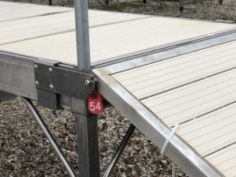
Standard dock ramps
When choosing between ramps vs. gangways, first, think about what your neighbors are using. Remember, your dock will most likely sit at the same height!
Would you, your family, or guests be comfortable going up that incline to use the dock?
Do they need a running start to get up to the dock? If they do, a ramp is not the way to go.
Ramps work great for a level or short distance up or down. They don’t need handrails due to their length, and the angle to the dock is not steep.
How high is your dock above the water?
On an inland lake, you usually are about 1 foot above the water at the most. Since the waves seldom get more than a foot high on a lake, you don’t have a steep climb to get to the dock. A simple ramp will do an excellent job for you.
One more thing to consider about a ramp
Please don’t allow yourself to be talked into using a ramps narrower than the dock itself. It’s an accident waiting to happen.
Someone walking to shore may get distracted and step off the dock expecting the ramp to be the same width. Foolish but true.
Ramps or gangways should always match the width of the dock. You don’t want someone stepping off the edge when they thought the dock was wider.
Consider your shoreline
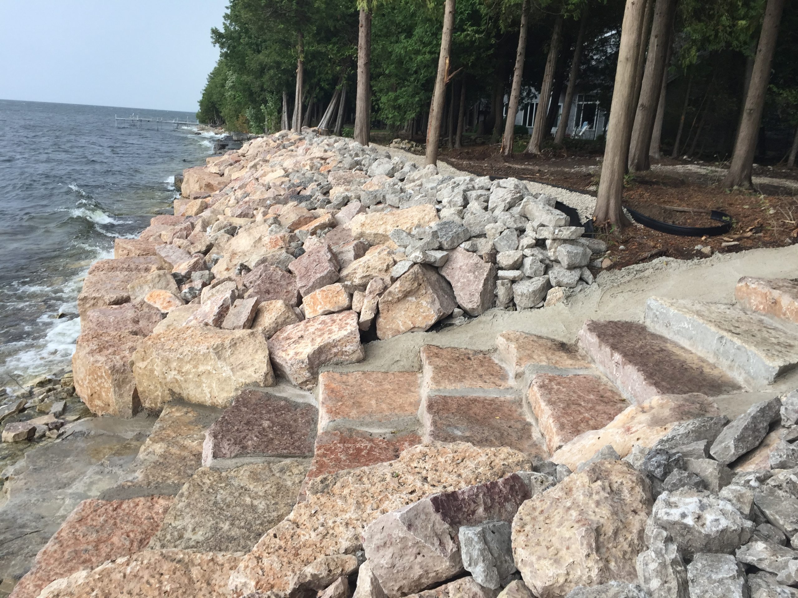
What do you have to walk over to get to your dock? Is it a sandy beach or a rocky shore with stones the size of the palm of your hand? Are there large boulders that only the kids enjoy climbing?
Is rip-rap only is the first obstacle followed by the rocks?
Now, with the rip-rap, you may experience a difficult time getting over the rocks. In some cases, the water is right up to the rip-rap.
Once over the rip-rap, you may have to walk over some rough terrain to get to the dock or pier.
Gangways are a safe and straightforward solution to your problem.
Consider both the length and width you need. For example, the PWS 3-Season Pier offers various pier and ramp widths and lengths to fit your needs.
PWS offers ramps and gangways with the same decking as the rest of your dock. It all fits together seamlessly.
Do you have rip-rap?
Due to the high water, you may have installed rip-rap along the shoreline to protect property values.
Now, with the large rip rap, you may have a difficult time getting over the rocks.
You may also have to walk over some rough terrain to get to a dock or pier.
What’s the solution?
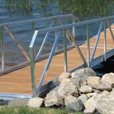
To start with, PWS can add stairs in the form of flat rocks or steel steps right in the rip-rap. From there, we have gangways in 20 ft. lengths to finish your walk over any obstructions.
Have an aluminum dock?
PWS has 16′, 20′, and 24′ lengths with handrails included. These significantly reduce the chance of a twisted ankle or a broken leg or arm.
No rip-rap?
The high water likely means your dock is higher than previous years to escape the waves’ power in a storm.
Now you need ramps or gangways to access the dock. A ramp, which is usually 8-10′ long, will give you a steep angle to climb under some circumstances.
The best way to access your dock when it is this high is via gangways. The longer gangways provide a gradual slope that young and old will appreciate.
A gentle transition from the shoreline to your dock is essential for a seamless, gentle climb. (As a side note, the long gangways mean you usually need fewer sections of the pier.)
PWS offers stairs, ramps, and gangways to access your dock.
One of the critical choices you’ll make is choosing between ramps and gangways.
What do you have to walk over to get to your dock?
What do you have to walk over to get to your dock – Sand, rocks, or boulders?
As you think about the length, make sure you keep in mind the ramp’s width. PWS has various options to suit your needs.
Ramps
If you don’t have far to walk (less than eight feet from shore to dock), a ramp is an excellent choice. That is unless the pier is set high.
Ramps are standard on shorelines where the water level doesn’t fluctuate much. The ramp is usually short enough that they don’t require handrails. However, longer approaches provide a gentle slope to a higher dock.
Aluminum Ramps come in 4′ x 4′, 4′ x 8′, and 6′ x 8′ sizes. The strength of aluminum does not normally allow for longer lengths without handrails.
PWS will advise you which type of dock access works best in your situation.
Gangways
If the distance from your dock to the shore is:
1. Long and you have to walk over large rocks or boulders:
2. The dock is set high: or
3. You get a lot of debris floating along your shoreline – Consider gangways rather than ramps.
Unlike ramps, gangways provide a gentle slope to walk up because of the distance they cover.
A 20′ gangway could reduce the cost of your dock system too.
Aluminum Gangways
Aluminum residential gangways are 4′ wide and come in lengths of 16′, 20′, and 24′.
An alternative for galvanized docks would be a steel gangway, which comes in 20′ lengths. As you can imagine, this longer length is much more comfortable with less incline.
Let’s summarize these ideas.
Let PWS find the Perfect Dock System for you.
Determining what a good fit would be is an integral part of making your dock system perfect.
PWS offers high-quality and affordable options for gangways, ramps, and accessories. We provide the expertise and expert knowledge you need to determine which option will work best for your situation.
PWS can help you plan the perfect boat docking system for your area.
Get started HERE!
Where is Pier & Waterfront Solutions?
Pier & Waterfront Solutions, 7325 St. Hwy 57, is located 3 miles south of Sturgeon Bay. It’s 1 mile PAST the intersection with County road MM (heading north). Look on the right at the intersection of Idlewild Road and Hwy 57.
ARE WE OPEN?
Pier & Waterfront Solutions remains “open” year-round.

Please use face masks
The virus continues to spread. PWS is conducting as much business as possible by email, text, or phone.
Site visits continue as usual. When making in-person contacts, we follow “social distancing” guidelines whenever possible.
Our display yard is OPEN 24-7
The PWS display area is always open for you to examine at your leisure. All displays available for sale have a numbered, red tag on them. Want more information on something you saw in our yard? Please reference that number when you inquire.
Red Tag
PWS will provide estimates by email to make the process faster, safer, and paperless.
Call, message, or email us with any questions.
Thank you for allowing us to work with you.